Category:Goring Gap
Jump to navigation
Jump to search
gorge in South East England formed by the River Thames   | |||||
| Upload media | |||||
| Instance of |
| ||||
|---|---|---|---|---|---|
| Location |
| ||||
 | |||||
Media in category "Goring Gap"
The following 10 files are in this category, out of 10 total.
-
 Goring Gap - geograph.org.uk - 1290101.jpg 640 × 480; 89 KB
-
 Goring Gap contour map.jpg 701 × 741; 165 KB
-
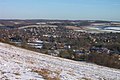 Goring Gap in winter.jpg 600 × 400; 62 KB
-
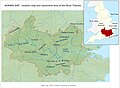 Goring Gap location map and catchment area.jpg 2,015 × 1,485; 448 KB
-
 Goring Gap.jpg 8,521 × 1,533; 2.43 MB
-
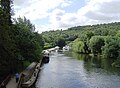 GoringGap01.JPG 1,973 × 1,442; 1.02 MB
-
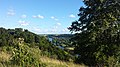
 Hartslock 01.jpg 1,836 × 3,264; 3.06 MB
-
 Hartslock 03.jpg 3,264 × 1,836; 3.13 MB
-
 Ordnance Survey Drawings - Reading (OSD 126).jpg 5,679 × 3,450; 4.7 MB
-
 Thames and Goring Gap location map.jpg 1,400 × 1,508; 432 KB


.jpg)
